The 275 trillion pounds of water from Hurricane Harvey deformed the ground in Texas.
The weight of water can deform the Earth’s crust, if there’s enough of it. And we can measure that change with the ultraprecise global-positioning satellites humans have launched into orbit.
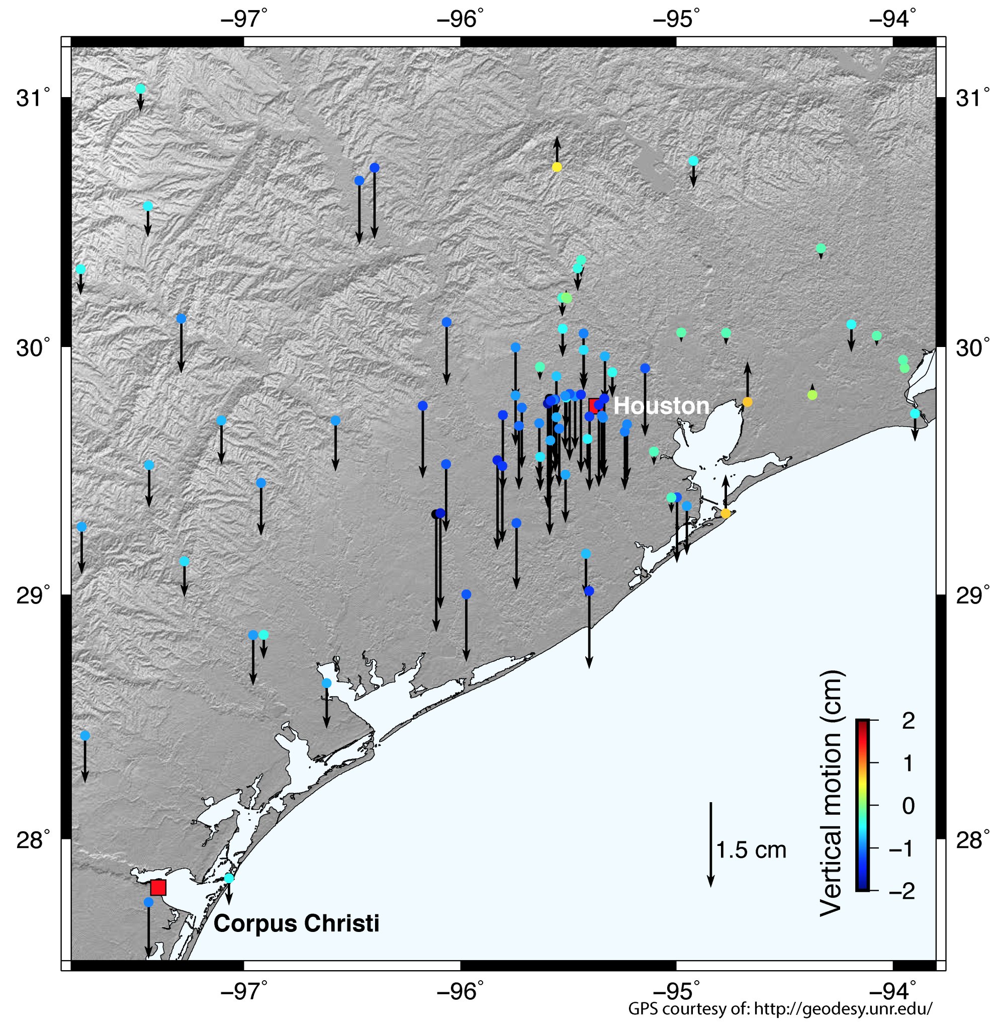
On Monday, Chris Milliner of the Jet Propulsion Laboratory tweeted a simple map visualizing data from the Nevada Geodetic Laboratory. It showed that the GPS data from special stations around Houston detected that the whole area had been pushed down roughly two centimeters by the weight of the water that fell during Hurricane Harvey.
That is a a lot of water.

