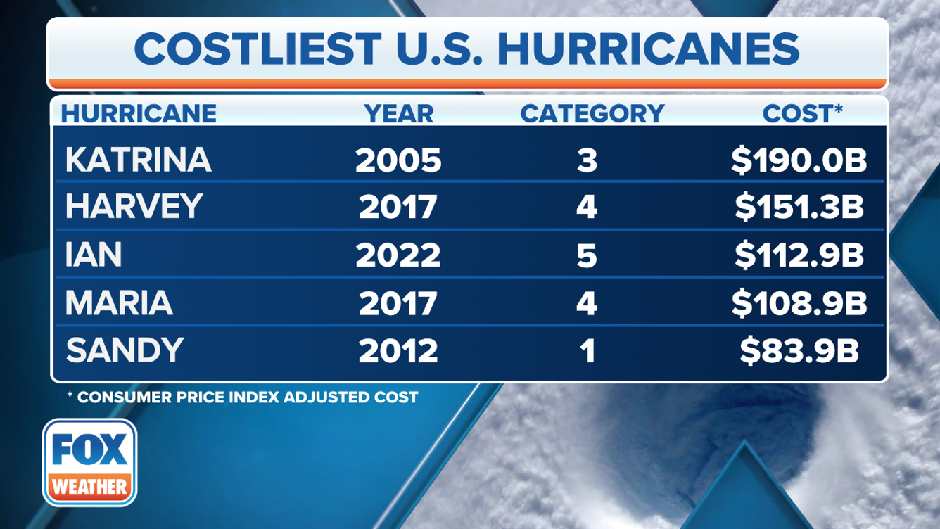
Interesting -- they finally got around to acknowledging that Ian was a Cat 5. I am hopeful that we are in a continued calm cycle
2023 hurricane season: Least impactful for US in nearly a decade According to initial estimates, between $3-$4 billion worth of damage was done during the 2023 hurricane season. The 2017 hurricane season ranks as the costliest in U.S. history, with around $300 billion worth of damage done. According to NOAA, a significant landfalling hurricane produces damage of around $22.8 billion.
The fourth most active Atlantic basin hurricane season in the satellite era has drawn to a close, but what could have been a season of records left the U.S. relatively unscathed compared to recent years.
According to NOAA estimates, between $3-$4 billion worth of damage was done during the 2023 hurricane season, making it the quietest season since 2015 - another El Niño year.
Idalia was the only U.S. landfalling hurricane in 2023
Hurricane Idalia, which struck Florida’s Big Bend as a Category 3 hurricane, was the most impactful cyclone and produced more than 80% of the season’s damage.
Government estimates put the damage tally at around $2.5-$3 billion, which was largely centered along the Gulf Coast, between Tallahassee and Tampa Bay..............
 https://www.foxweather.com/weather-news/hurricane-season-2023-summary-recap