Here's a map of the Washington D.C. area showing the beltway (i.e., the broader area):
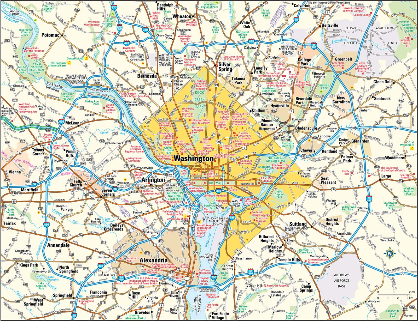
The thing to keep in mind is that a lot of the people who work in D.C., particularly the government workers, live just inside, or outside, the Beltway. Goods being delivered both to D.C. and to the areas immediately surrounding D.C. also depend quite heavily on the Beltway to get from point A to point B.
As a result, one can see a number of strategic choke-points that, if clogged with vehicles, would effectively shut down access to D.C. (both coming out and going in), and it would not take too many vehicles to accomplish that result. Furthermore, there are several points on the Beltway itself where, owing to the terrain, it narrows down to fewer lanes than in general. These also constitute choke-points that could be used to stifle traffic flow into and out of D.C.
Once the Beltway and the major highways going into D.C. are choked off, or even just substantially slowed down, rush hour traffic, in particular, will start spilling over to the surface roads, and that will bring the entire region to a standstill.

