Way out there, not be a concern, and even could die. But here is a system (wave) that the NHC is tracking, and right now seems destined to enter the Caribbean in about a week, and maybe points of concern in 2 weeks. At this moment the NHC seems pretty confident a depression will form in the next few days. Note: Red graphic is the one to focus on. Not the yellow. 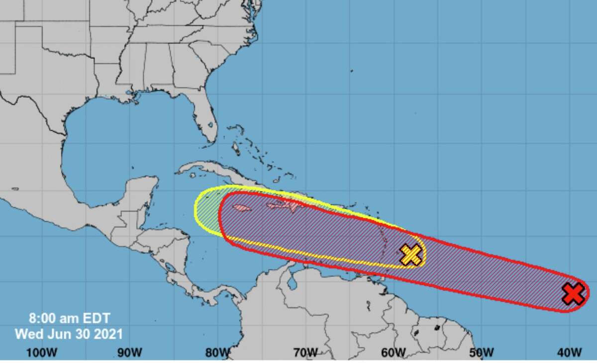
Tropical Weather Outlook
NWS National Hurricane Center Miami FL
200 PM EDT Wed Jun 30 2021
For the North Atlantic...Caribbean Sea and the Gulf of Mexico:
1. Showers and thunderstorms associated with a broad low pressure area
and tropical wave located about 1300 miles east-southeast of the
Windward Islands have become better organized since yesterday.
However, recent satellite wind data indicates that the disturbance
does not have a well-defined circulation. Environmental conditions
appear generally favorable for continued development, and a tropical
depression or storm is likely to form during the next day or two
while the system moves west-northwestward at 20 to 25 mph.
Interests in the Lesser Antilles should closely monitor the progress
of this system, as advisories on a potential tropical cyclone,
accompanied by tropical storm watches for portions of this area, are
likely to be issued later today.
* Formation chance through 48 hours...high...70 percent.
* Formation chance through 5 days...high...90 percent.

