September 5th, 2020 by Roy W. Spencer, Ph. D.
The August 10, 2020 derecho event caused an estimated 40 million acres of nearly-mature corn crop to be significantly damaged or destroyed, mainly in Iowa, but also in portions of Nebraska, South Dakota, Illinois, Minnesota, Wisconsin, Indiana, Ohio, and Missouri.
I put together this NASA Terra satellite MODIS imager comparison of the area as imaged on September 2 in both 2014 (a normal crop year) and in 2020, a few weeks after the derecho struck. This date is sufficiently past the event to show areas where the crops are dead and dying. (Click on image if it doesn’t animate.)
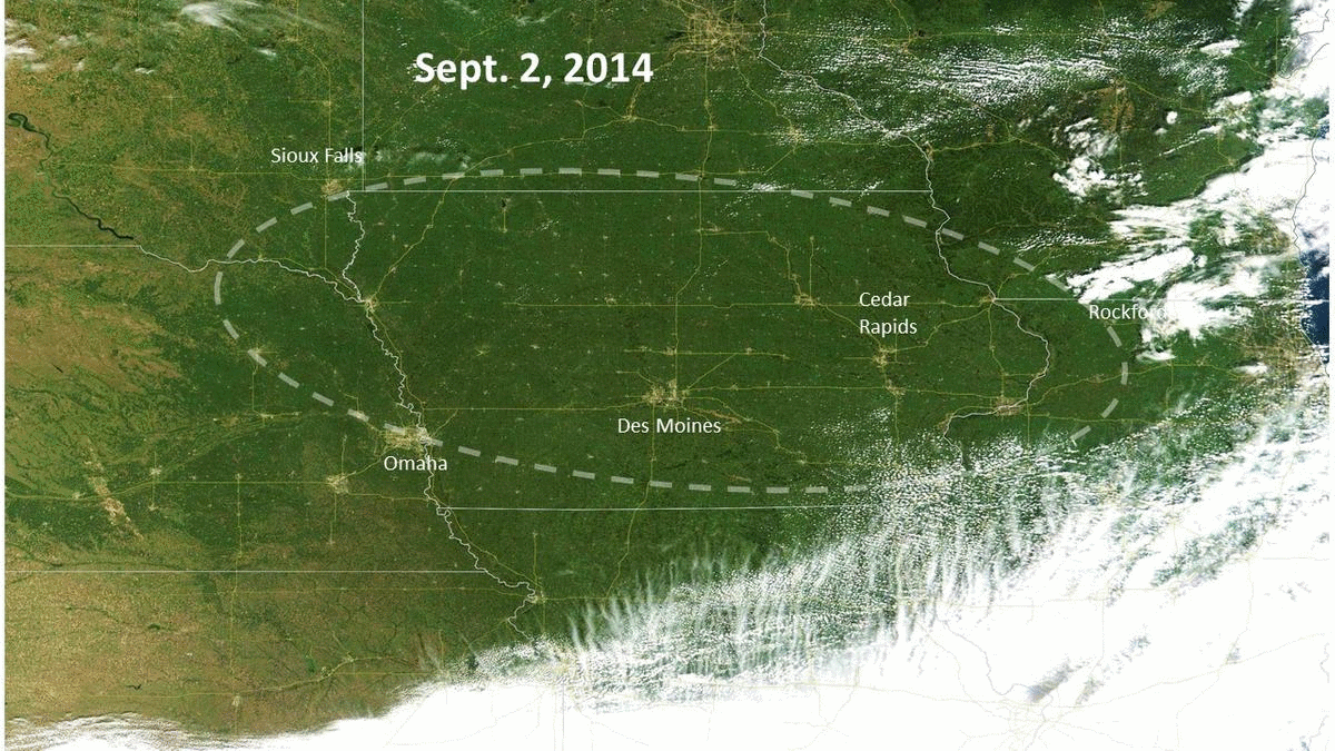
The dashed line in Fig. 1 shows the approximate area where crop damage seems most extensive.
What Causes Derechos? How Common are They? Can they Be Predicted?
Derechos are severe thunderstorm “squall line†high wind events that are particularly widespread and long-lived, typically moving rapidly across multiple states. This video taken in Cedar Rapids shows about 25 minutes of very high winds, with occasional gusts taking out trees and tree limbs.
More:
https://www.drroyspencer.com/2020/09/derecho-iowa-corn-damage-imaged-by-satellite/Error 404 (Not Found)!!1

